GPS Block IIR(M) satellite, (public domain)[https://www.gps.gov/multimedia/images/]
How does satellite navigation work, and how can it be used for tracking?
GPS Block IIR(M) satellite, (public domain)[https://www.gps.gov/multimedia/images/]
In a scramble to track, and thereby stem the flow of, new cases of COVID-19, governments around the world are rushing to track the locations of their populace.
In this third installment of our Covid-19 tracking technology primers, we look at Satellite Navigation technology. In Part 1 of our mini-series on we discussed apps that use Bluetooth for proximity tracking. Telecommunications operators ('telcos'), which we discussed in Part 2, are also handing over customer data, showing the cell towers that phones have connected to and therefore triangulating an individual's location. Internet companies are also providing access to location data they have derived.
Many of us have used Satellite Navigation ("SatNav") for getting around in an area we don't know, but just how does it work?
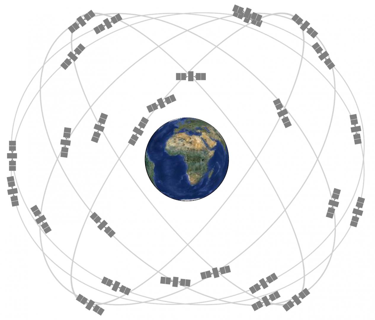
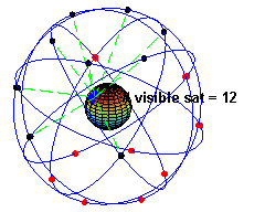 Satellites orbit the Earth at around 20,000km (~12,000mi) above sea level, although the exact height depends upon the system. The orbits for these satellites are tightly controlled, ensuring the satellites take 12 hours to circle the Earth, completing two orbits in a 24-hour period, and making sure that multiple satellites are always in view anywhere on Earth.
As these satellites orbit, they broadcast their location and the current date and time as measured by an onboard atomic clock {t1}. These broadcasts travel through space at the speed of light; nearly 300,000km/second (~180,000mi/second).
When a device on Earth receives a signal, it records the exact time of receipt {t2} and uses algebra first credited to Galileo Galilei to calculate its distance from the satellite:
distance = speed x time
Distance = Speed of Light x (t2 - t1) gives us the device’s relative distance to the satellite. Once it calculates its distance from four satellites, it can calculate its position on the surface through simple geometry.
GPS is just one Satellite Navigation System, however - there are several publicly available systems and recent SatNav receiver implementations are able to "listen" to multiple sources at the same time. This enables the SatNav systems to gain a faster "fix".
Anyone who has used a SatNav app on their smartphone will have seen something very similar to how a COVID-19 SatNav app will work; the device/app will record your movements as latitude/longitude - a raw location on the Earth's surface - as well as recording your vertical height above sea level, direction of travel, and speed.
It is important to note that satellite navigation is done entirely on the recipient device, there's not a two-way communication with the satellites themselves. This means that the actual tracking implementation is up to the app, rather than the satellite technology itself.
Like all radio signals, satellite navigation is heavily affected by interference and background noise, whether intentional or not. It is also line-of-sight, meaning you have to be able to 'see' a satellite. Buildings and other structures can badly interfere with SatNav, as the satellite signals are easily reflected off surfaces, which adds extra time (and therefore increasing the measured distance), or such constructions can block the signals entirely.
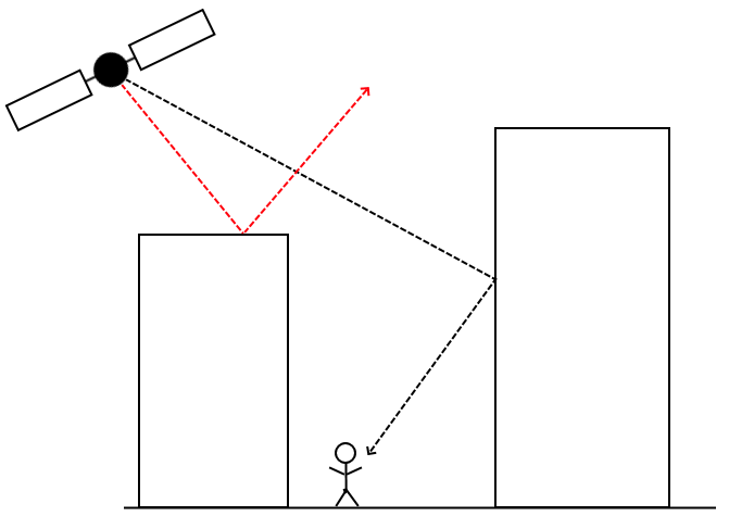
Different satellite navigation systems provide different accuracies, however the accuracy available to the receiver itself is determined by its chipset; for example newer GPS satellites offer accuracy to ~30cm (~11.5in), but GPS on a mobile phone is typically accurate to ~5m (16ft), even in an area with a clear view of the sky.
Although newer (and/or more expensive) satellite navigation receivers are able to filter out these reflected signals and get down to much smaller accuracy, these drawbacks combined make satellite navigation on a mobile phone practically useless at proximity tracing.
Satellite Navigation can be seen as a middle-ground between Bluetooth tracking and Telco data tracking;
Because of the lack of accuracy and high rate of interference of most devices, satellite navigation cannot be relied upon for proximity tracing. Instead, its likely use will be in enforcing lock-down and making sure that people don't leave a given area. This is most likely to be done through the use of 'Geofencing', which is an alert sent when a device leaves a given area. Who receives these alerts will be up to the app provider, but this is likely to be a Government agency or the Police.
The risks associated with tracking do not just occur at the time the data is collected, but continue as long as it is stored -- in particular once it has been linked to an individual. Thus there are concerns about how data such as these could be repurposed by Governments.
As with everything we’re seeing in the age of Covid-19, we must be highly aware of the limitations of the choices we are offered. It is also important that technical and legal safeguards around the processing and storage of data – especially when those data can be used for deanonymisation – are not bypassed or ignored in the rush to deploy technology. Regardless of how well-meaning or indeed vital it may be. It’s also important to ensure that there exists a genuine need to use location tracking that is supported by the scientific evidence, given satellite navigation's obvious usage being for the enforcement of lock-down rather than proximity tracing.